Municipal Administration & Urban Development Department Narasapuram Municipality, West Godavari District – Division of Narasapuram Municipality into thirty one (31) Wards The Commissioner, Narasapuram Municipality is directed to place the following Notification before the Municipal Council of Narasapuram Municipality for its views /suggestions besides giving wide publicity to the Notification as contemplated in rule 11 of the Andhra Pradesh Municipalities (Division of Nagara Panchayats and Municipalities into wards) Rules, 1994.
The Collector and District Magistrate, West Godavari District is directed to affix the appended Notification on the notice board of his office to give an opportunity to make suggestions about the division of the Municipality into wards.
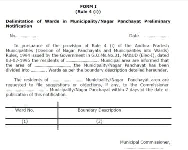
Under clause (a) of sub-section (1) of section 10 of the Andhra Pradesh Municipalities Act, 1965 (Andhra Pradesh Act, 6 of 1965) read with rule 11 of the Andhra Pradesh Municipalities (Division of Nagar Panchayats and Municipalities into wards) Rules, 1994 issued in G.O.Ms.No.31, Municipal Administration & Urban Development Department, dated 03.02.1995 and after due consideration of the proposals submitted by the Commissioner and Director of Municipal Administration, Andhra Pradesh, Guntur, the Government hereby notify the draft delimitation of thirty one (31) wards of Narasapuram Municipality as specified in the schedule appended to this Notification.
The Municipal Council, Narasapuram Municipality is informed that it shall submit its views /suggestions, if any, on the proposed draft delimitation of wards notified, within 7 days of the publication of this Notification in the Andhra Pradesh Gazette, to the Commissioner, Narasapuram Municipality.
The people of Narasapuram Municipality are informed that they may submit their views/suggestions, if any, on the proposed draft delimitation of wards notified, within 7 days of the publication of this Notification in the Andhra Pradesh Gazette, to the Commissioner, Narasapuram Municipality.
A copy of the Notification is also sent to the Collector and District Magistrate, West Godavari District and he/she is requested to affix the same on the Notice Board of his office and he/she is requested to give his / her suggestions about the division of the aforesaid Municipality into thirty one (31) wards to the Government immediately.
The Municipal Commissioner, Narasapuram Municipality and the Collector and District Magistrate, West Godavari District may follow the procedure as stipulated under rule 12 of A.P. Municipalities (Division of Nagar Panchayats and Municipalities into wards) Rules 1994 and send their report to the Government through the Commissioner and Director of Municipal Administration, A.P., Guntur, immediately.
ANNEXURE TO G.O.MS.NO. , MA&UD(G) DEPARTMENT, DT.10.01.2020 DESCRIPTION OF WARD BOUNDARIES OF NARSAPURAM MUNICIPALITY INTO THIRTY ONE
WARD-01
NORTH: Starting from the Municipal limits on the Western boundary of Narasapuram – Palakollu road in R.S.No.145 and crossing the road up to Eastern boundary of the road and turning towards North and running along Eastern boundary of Narasapuram – Palakollu road up to North West Corner of R.S.No.145 and then running to east and running along the Municipal limits on the Northern boundaries of up to the North – East corner of Madavaipalem Revenue Village.
EAST: Starting from North-East corner of R.S.No.101 and running towards South along Municipal limits on the Eastern boundary of R.S.No.101 and 102 up to North-East corner of R.S.No.107,and running towards R.S.No.108,109 on Vasista Godavari and then running towards South along the Vasista Godavari bund up to the North-East corner of R.S.No.110
SOUTH: Starting from the above point NE Corner Of R.S. No.110 and Vasista Godavari bund and running towards southern boundaries of R.S.NO.110 and 151 of Madavaipalem Revenue Village up to Summer Storage Tank Western boundary POINT and again turning south along the western boundary of the SS Tank up to water works roads and again turning west up to the Narasapuram – Palakol Road.
WEST: Starting from the above point and turning North along Narasapuram – Palakol Road Up to the Municipal limits on the Western boundary of Narasapuram –Palakollu road in R.S.No.145
Ward-02
NORTH: Staring from the NW Corner of SS Tank running east along the northern boundary of SS Tank up to the NE corner of R.S.NO.178.
EAST: Staring from the above point running towards south along the Vasisita Godavari bund up to the baswani kondayya street.
SOUTH: Starting from the above point along the southern boundary of the Baswani Kondayya Street up to the Gudavari Street and again turning north along the Gudavari street up to the Chalavapeta Ambedhkar Community Hall and again turning West along the chalavapeta road up to the Annapurna Theatre up to bromley Compound Street.
West: Starting from the above point NW corner Annapurna Theatre turning towards North along the water works road up to the NW Corner of SS Tank
Ward-03
NORTH: Starting from the Narasapuram –palakol road running towards east along the water works bypass road up to Bramley Compound street and again running south along the bramley compound street up to Annapurna theater and again turning east along the chalavapeta road up to gudavari street (beside of Ambedhkar community hall).
EAST: Starting from the above point turning south along the running along Godavari Street up to Streamer road.
SOUTH: Starting from the above point and turning to west towards running steamer road up to the prakasam road(main road).
WEST: Starting from the above point running towards north via prakasam road up to the water works bypass road.
Ward-04
NORTH: Starting from the NW corner of Basvani Kondayya Street running along the East side up to Vasista Godavari Bund.
EAST: Starting from the above point turning south along the Vasisita Godavari bund up to the steamer road (up to Ferry point).
SOUTH: Starting from the ferry point of steamer road running along the west side up to sankavari street and again turning north along the sankavari street up to the madavaipalem School street and again turning west side along the along the madavaipalem School street up to the Gudavari street.
WEST: Starting from the above point turning north along the Guda Vari Street. Up to the Basvani Kondayya Street
Ward-05
NORTH: Starting from the Guda vari street (Ramalayam Temple)junction and running cherukuri barmhanadam house towards running madavaipalem street and again turn to East side up to sankavari street and again turning south along the sankavari street up to the steamer road(up to ferry point).
EAST: Starting from the ferry revu running south side towards running lalithamba temple up to valandara revu.
SOUTH: Starting from the above point running along the western boundary of YNM College Street up to Siddani vari Street.
WEST: Starting from the above point running towards North along the Siddani
Vari Street up to Sivalayam Street and again turning east side along the Sivalayam Street upto yerramilli vari street and again turning north along the yerramilli vai street up to steamer road up the Guda vari street (ramalayam temple).
Ward-06
NORTH: Starting from the steamer road and ember manner swami temple street corner running towards east along the steamer road up to the tailor high school eastern boundary.
EAST: Starting from the above point turning south along the yerramilli varistreet up to Sivalayam Street.
SOUTH: Starting from the above point turning west along the sivalayam street up to YNKV hall Street.
WEST: Starting from the above point turning towards north along the YNKV Hall Street to via TTD Kalyamandapam along the ember manner swami temple street & steamer road junction.
Ward-07
NORTH: Starting from the Prakasam road & steamer road junction to along running east along the steamer road up to the steamer road and ember manner swami temple street junction.
EAST: Starting from the above point running towards south along the Ember
manner swami Temple Street and YNKV hall Street up to the Sivalayam Street and again turning east and running along the sivalayam street up to the Siddani vari street and again turning south along the siddanivari street up to the YN College street.
SOUTH: Starting from the above point running towards west along the YN College Street up to Prakasam Street (main road)
WEST: Starting from the above point running towards north along the
Prakasam Street up to Prakasam road & steamer road junction.
Ward-08
NORTH: Starting from the Junction of Prakasam road & Y.N College Street running towards east along the Y.N College street up to Valandararevu.
East: Starting from the above point running towards south along Godavari bund up to burial ground street (up to FST&ETP Plant).
SOUTH: Nill
WEST: Starting from the from the above point towards running north along the burial ground street up to valalamma temple and running towards east along the mokavari palem up to Nandamuri colony junction and running towards north along the Taylor high school ground street up to Prakasam road & Y.N College Street junction.
Ward-09
NORTH: Starting from the old bazaar running towards east along swarajyaram street upto swarajyaram street and prakasham street junction.
East: Starting from above point running towards south along the taylor high school ground street up to mokavari palem road.
SOUTH: Starting from above point running towards west along the moka vari palem upto valavalaraju street.
WEST: Starting from above point running towards north along valavala vari street up to old bazaar.
Ward-10
NORTH: Starting from the park road and jagilinki vari street junction toward running towards east along the jagiliki vari street up to prakasham street.
East: Starting from above point running towards south along the praksaham road up to swarjyaram street. .
SOUTH: Starting from above point running towards west along the swarajyaram street up to the park street .
WEST: Starting from above point running towards north along the park street upto the park road and jagilinki vari street junction.
Ward-11
NORTH: Starting from the Junction of kummaripeta and mogaltur road junction and running towards east along the mogaltur road upto the junction of anjuman building and prakasham road.
EAST: Starting from above point running towards running south along the praksham road upto the jagilinki vari street.
SOUTH: Starting from above point running towards running west along the jagilinki vari street up to the park road and crossing park road along the balayya garden street and rupram street and kummaripeta junction.
WEST: Starting from above point running towards running north along the kummaripeta road upto kummaripeta and mogaltur road junction.
Ward-12
NORTH: Starting from the junction of Vastaduvari Street and Mogaltur road (near church)and running towards east along the northern boundaries of Mogaltur road up to of Kummaripeta.
EAST: Starting from the junction of mogaltur road and kummaripeta and running towards south along the western boundary up to gubbalavari junction.
SOUTH: Starting from the gubbalavari junction towards running west via addagallavari street and maddipatlavari street and again running west upto park road.
WEST: Starting from the above point towards running north upto (via church
road) Vastaduvari Street and Mogaltur road junction.
Ward-13
NORTH: Starting from the junction of Maddipatlavari Street and addagalla avri street running towards north up to gubbala vari street and running towards east upto park road.
EAST: Starting from the above point and running towards south along the park road upto via swarajyaramam street (old bazaar center) and again running towards south along valavala vari street up to ramalayam.
SOUTH: Starting from the above point and running towards west along borra saheb street up to peechupalem road
WEST: Starting from the above point and running towards north along peechupalem road upto maddipatlavari street junction.
Ward-14
NORTH: Starting from the peechupalem road and borrasaheb street junction and running east up to valavala vari street.
EAST: Starting from the above point running towards south along valavala
vari street to mokavari palem street and ankani vari palem street junction and again turning west along mokavaripalem street up to burial ground street and again turn south along burial ground street upto Vasista Godavari bund running towards south along Godavari river bund up to R.S.No.98
SOUTH: Starting from the above point running towards west along the karthikeya nagar layout road upto Peechupalem road.
WEST: Starting from the above point running towards north along the peechupalem road upto borra sahib street junction.
Ward-15
NORTH: Starting from the NW Corner of R.S.No.637 and running towards east touching the southern boundary of R.S.No.35 and further proceeds east up to the junction of Malem street and again turn east along malem street up to patta vijaya Samuel street and again turn east along patta vijaya Samuel street up to the junction of patta vijaya samuel street and darga street
EAST: Starting from the junction of patta vijaya samuel street and darga street road junction running towards south along the peechupalem road up to NW Corner of R,.S No.76 and running towards karthikeya nagar layout road upto Godavari bund and running south along the Godavari bund upto R.S.NO.104
SOUTH: Starting from the above point an running west along the municipal limits in the R.S.No.89 and 88 up to the SW Corner of R.S.No.637.
WEST: Starting from the municipal limits in SW corner of R.S.No.87 and passing through R.S.No.86,87,85,84,640 and 638 up to SW Corner along municipal limits and turning to north along the western boundary of R.S.No.636 up to the NW Corner of R.S.No.637.
WARD-16
NORTH: Starting from the Junction of Pillipeta main road(Gandhi nagar) and Zonah road and running towards East along Southern boundary of Zonah road up to the junction of Panja center
EAST: Staring from the junction of Panja center and turn south along the peechupalem road up to patta vijayasamuel street.
SOUTH: Staring from the above point and turn west along patta vijayasamuel street up to pillipeta main road.
WEST: Starting from the above point and turn north along Pillipeta main road up to the junction of Pillipeta main road(Gandhi nagar) and Zonah road (Mission High school road).
WARD-17
NORTH : Staring from the junction of rest house road and Bala Chandra Mouleswara Swamy Temple street and then turning towards East and running along the southern boundary of Balachandra Mouleswara Swamy Temple street up to the junction of Vastaduvari street.
EAST : Staring from the Junction of Balachandra mouleswara swamy temple street and vastaduvari street and proceeding towards South along the Eastern boundary of vastaduvari street up to the junction of Maddipatlavari Street and then turning to East and running along the southern boundary of maddipatlavari street up o the junction of kadimcherlavari street up to the junction of Mosque street.
SOUTH : Staring from the junction of Kadimcherlavaari street and Mosque street and running towards west and running along Southern boundary of Darga street up to the junction of darga road and after crossing Darga Road again proceedings towards West along southern boundary of jona road (Mission High School Road ) up to the junction of Avvaru Kamaiah Street.
WEST : Staring from the junction of Jona road (Mission High school road ) and Avvari kamaiah Street and proceedings towards North along the Western boundary of Avvari kamaiah street up to the junction of Devunithota road and then turning to West up to the junction of Rest house Road and running towards North along up to the junction of Balachandra mouleswara swamy street.
WARD-18
NORTH: Starting from the junction of Mrutyam jaya nagar street and mogaltur road and running towards east along Northern boundary of Mogaltur road up to junction of vastaduvari street near church.
EAST: Starting from the junction of mogaltur road and vastaduvari street and running towards South along the Eastern boundary of vastaduvari street up to the junction of Balachandra Mouleswara Swamy Temple Street.
SOUTH: Starting from the junction of Vastaduvari street and Balachandra Mouleswara Swamy Temple Street and running towards West along the Southern boundary of Balachandra mouleswara Swamy temple street up to the junction of Municipal Office road (gues house road)and again running towards south guest house road up to the junction of devunithota road and then turning long the western boundary of avvari kamayya street up to the junction of zonah road junction and then turning towards west and running northern boundary of zonah road(Mission high school road) up to the buddiga venkanna lane and zonah road(Mission high school road) junction.
WEST: Starting from the above point running towards north along the buddiga venkanna lane up to the devunithota road and again running towards east along devunithota road up to the mrutyunjeya nagar road junction. And again turning nirth along the mryutyunjeya nagar road up to the junction of Mrutyam jaya nagar street and mogaltur road.
WARD NO 19
NORTH: Starting from the junction of Potti Sriramulu street and mogaltur road and running towards east along Northern boundary of Mogaltur road up junction of Mrutyam jaya nagar street and mogaltur road
EAST: Starting from the junction of Mrutyam jaya nagar street and mogaltur road and running towards South along Mrutyam jaya nagar street up to junction of devunithota road.
SOUTH: Starting from the junction of Mrutyam jaya nagar street and devunithota road and running towards west along the devunithota road up to the potti srirtamulu street.
WEST: Starting from the above point running towards north along the potti srirtamulu street up to the junction of Potti Sriramulu street and mogaltur road.
WARD-20
NORTH: Starting from the Junction of NTR Colony road & Zonah road(Mission high school road) running towards east along up to pilli peta road.
EAST: Starting from the Juncion of pillipeta & Zonah road(Mission high school road) turn towards south along the pillipeta road upto malem street junction.
SOUTH : Starting from the above point running towards west along the along the southern boundary of malem street and passing through southern boundary of N.T.R Colony puntha road.
WEST: Starting from the above point running towards North along eastern boundary of N.T.R Colony upto N.T.R Colony road and again turn west along the N.T.R Colony main road and turn north along the N.T.R Colony main road and upto the Juncion of NTR Colony road & Zonah road(Mission high school road).
WARD-21
NORTH: Starting from the Junction of muddalavari street & Zonah road(Mission high school road) running towards east along up to the Juncion of NTR Colony road & Zonah road(Mission high school road) road.
EAST: Starting from the above point running towards south along NTR Colony main road and turn east on N.T.R Colony up to Eastern boundary of NTR Colony and again turn south running along eastern boundary of NTR Colony puntha road
SOUTH : Starting from the above point running towards west along the NTR Colony puntha road up to B.C. Hostel road and turn west along palaparthi vari street up to mudddala vari street.
WEST: Starting from the above point running towards North along muddala vari street up to from the Junction of muddalavari street & Zonah road(Mission high school road).
WARD-22
NORTH: Starting from the Junction of vemuladeevi channel & Zonah road(Mission high school road) running towards east along up to the Junction of muddalavari street & Zonah road(Mission high school road)
EAST: Starting from the above point running towards south along the muddala vari street up to kotha colony road and SE Corner of R.S.No.632.
SOUTH : Starting from the above point running towards west along R.S.No.632 and running along municipal limits upto vemuladeevi channel.
WEST: Starting from the above point running towards North along vemuladeevi channel up to the Junction of vemuladeevi channel & Zonah road(Mission high school road).
WARD-23
NORTH: Starting from the junction of Vemula deevi channel and mogaltur road and running towards east along Northern boundary of Mogaltur road up junction of Potti sriramulu street and mogaltur road.
EAST: Starting from the above junction and running towards South along of Potti sriramulu street up to junction of devunithota road and again running towards as along the devunithota road up to the buddiga venkanna street and again running towards south along the buddiga venkanna street up to the junction of Jonah road (Mission High school road)
SOUTH : Starting from the above point and running towards west along the zonah road up to the Vemula deevi channel.
WEST: Starting from the above point running towards north along the Vemula deevi channel up to the junction of Vemula deevi channel and mogaltur road.
WARD-24
NORTH: Starting from the junction of Rusthumbada sivalayam street and mogaltur road and running towards east along Northern boundary of Mogaltur road up to the Vemuladeevi channel and Mogaltur road junction.
EAST: Starting from the above junction and running towards South along of Vemuladeevi channel up to junction of zonah road junction (Mission High school road) road.
SOUTH: Starting from the above point and running towards west along the gadhavarjula vari street and up to the sivalayam street at eastern boundary of manginavari Nagar.
WEST: Starting from the above point running towards north along the sivalayam street up to the the junction of Rusthumbada sivalayam street and mogaltur road
WARD-25
NORTH: Starting from the junction of Rusthumbada jadannadaswamy temple and running towards east along gadhavarjula vari street up to tevemula deevi channel.
EAST: Starting from the above junction and running towards South along of Vemuladeevi channel up to municipal limits in the SE Corner of R.S.No.614.
SOUTH : Starting from the above point and running towards west along the municipal limits to Weavers colony Road.
WEST: Starting from the above point running towards north along the weavers colony road up o the Kollabathula vari meraks road and again running towards wst along kollabathula vari meraka road up to the weavers colony limits and again running towatds north along Weavers Colony limits and again turning east along the HB Colony road upto the weavers colony road and again running towards north along kollabathula vari meraka road up to the junction of Rusthumbada jadannadaswamy temple.
WARD-26
NORTH:Starting from the parakala seshavataram canal bund and NW Corner of R.S No.473 and running east along the northern boundaries of R.S.No.473,474,475 up to the Kollabathula vari meraka road.
EAST: Starting from the above junction and running towards South along Kollabathula vari meraka road up to the H.B.Colony road and again turning east along HB Colony road up to the Weavers colony Western boundary and again running south along the Western boundary of Weavers colony up to the Kollabathula vari meraka road and again turning east along kollabathula vari meraka up to the weavers colony road and again turning towards south along weavers colony road up to the Municipal limits of SE Corner of R.S.No.461.
SOUTH : Starting from the above point and running towards west along the municipal limits of R.S.No.459,460 up to parakala seshavataram canal bund.
WEST: Starting from the above point running towards north along the parakala seshavataram canal bund up the SW boundary of R.S.No.473.
WARD-27
NORTH: Starting from the parakala seshavataram canal bund and mogaltur road and running towards east along the mogaltur road upto junction of Rusthumbada sivalayam street and mogaltur road.
EAST: Starting from the above junction and running towards South along svalayam street up to the zonah road (mission high school road) and running towards east along zonah road (mission high school road) up to the jagannada swamy temple and again running towards south along the kollabathula vari meraka road up to SE corner of R.S.No.479.
SOUTH : Starting from the above point and running towards west along the south boundaries of R.S.No.479,480 up to parakala seshavataram canal bund.
WEST: Starting from the above point running towards north along the parakala seshavataram canal bund up the parakala seshavataram canal bund and mogaltur road.
WARD-28
NORTH: Starting from the NW Corner of R.S.No.123 in the Municipal limits and
running towards east passing through the northern boundaries of R.S.No.123,122,137,141,142,140 & SE corner of R.S.No.158
EAST: Starting from the above points of SE Corner of R.S.No.158 and running towards south up to after crossing murugu drain further proceeding to south along crossing the thamous bridge up to Mogaltur road.
SOUTH : Starting from the above point and running towards west along the Northern boundary of mogaltur road up to running along the western boundary of R.S.No.542.
WEST: Starting from SW boundary of R.S.No.542 in municipal limits and running along the Municipal limits in R.S.no.546,547,534,182,181,185,186,189 and 133 up to NW Corner of R.S.No.123 in municipal limits.
WARD-29
NORTH: Starting from the NW Corner of R.S.No.345 and running towards east along the Northern boundaries of R.S No.345, 335, 334, 310, 309, 361, 286 and Northern boundary of R.S.No.397.
EAST: Starting from the NE Corner of R.S.No.397 and running towards south upto medarla bridge.
SOUTH : Starting from the above point and running towards west along the mogaltur canal north side bund up to Thomas bridge at kondeti ramaiah street up to R.S.No.158 and along the Northern Boundaries of 158, 140, 142, 141, 137, 122, 123.
WEST: Starting from the junction of the above point running towards north along municipal limits in western boundaries of R.S.No.117,345.
WARD-30
NORTH: Starting from the NW Corner of R.S.No.161 and running towards east along the municipal limits of R.S.No.161,160,166,167 and up to 168.
EAST: Starting from the NE Corner of R.S.No.168 and running towards south along the eastern boundaries of R.S.No.168,176 and SE Corner of R.S.No.187 and again Starting from the above point SE Corner of R.S.No.187 and running towards east along the Matsyapuri and Bhimavaram Road up to the NE corner of R.S.No.262 and again running towards south along necklace road upto NE corner of R.S.No.397.
SOUTH : Starting from the above point running towards west along the Northern boundaries of R.S No.397,286,361,309,310,334,335,and 345.
WEST: Starting from the above point running towards North along the western boundaries of R.S No.345, 340, 339, 338, 332, 333, 332, 324, 322, 195, 183, 182, 162 and up to NW Corner of R.S.No.161.
WARD-31
NORTH: Starting from the NE Corner of R.S.No.168 and running towards east along the municipal limits R.S.No.169, 170, 171, 208, 209, 210, 211, palakol-narsapur railway line, 412, 233, 231, 230, 229, 228, 227, 226, 225, 224, 223, 222, 221 and 220
EAST: Starting from the NE Corner of R.S.No.220 and running towards south along the eastern boundaries of R.S.No.220,257,258 and up to the Matsyapuri and Bhimavaram Road up to the NE corner of R.S.No.262
SOUTH : Starting from the above point running towards west along the Matsyapuri and Bhimavaram Road up to SE Corner of R.S.No.187
WEST: Starting from the above point running towards North along the eastern boundaries of R.S No.187,176,168 up to NE Corner of R.S.No.168.