


Among the meteorological phenomena that are developing and starting to have more relevance, there is Fengal cyclone. Many expect it to make landfall almost around Puducherry, and this has caught the attention of both the meteorologists and the coastal population in this developing system. Her name is Cyclone fengal, How did she progress, and what impact can it have? The answers to these questions will be given in this article.
What is the relation of the word fengal with Cyclone Fengal
According to the countries encompassed within the World Meteorological Organization, there is a list that each country or region must follow to name the cyclones that form in the Indian ocean. There was a proposal made by China to use Fengal , which only goes to show how resources and efforts are joined together when cyclonic activities have to be monitored. Whenever a depression intensifies into a cyclonic storm, the name is given in the order in which the storm picked up.”
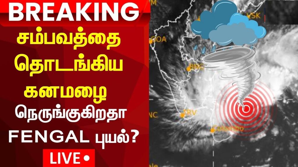
Now a new low-pressure area is coming up over the Southeast Bay of Bengal and over the East Equatorial Indian Ocean, which is being closely monitored. In the case when this system further strengthens into a cyclone, it will be officially termed as ‘Fengal’.
Bay of Bengal’s Cyclone Development
As initially it was a cyclonic circulation, so the India Meteorological Department (IMD) has been keeping an eye on such evolvement of systems into low pressure. This low pressure area evolved into a depression by the 25th Of November with predictions of it becoming a deep depression followed by a depression that can further become a Cyclone.
A deep depression has been developed into a cyclone on the 26th of November as by the Regional Meteorological Centre of India situated in Chennai. It is also estimated that by the 27th of November this cyclone is likely to strengthen even more and move North-Northwest as ‘Cyclone Fengal’.
Warnings issued for the Cyclones Development Urged for Tamil Nadu and Andhra Pradesh
IMD has issued a cyclone warning for Tamil Nadu, Pongy and Andra Pradesh as there coastline approaches. Bearing in mind that the temperature of the bay of Bengal water surface is likely to evolve from 28 to 30°c.
Key forecasts include but are not limited to:
Scope of movement and Power: at approximately 12km an hour the system is moving as wind reaches 25 to 30 knots and gusting at 35 knots.
Heavy Rainfall: Moderate to heavy showers are likely to occur in several coastal areas, including Kanchipuram, Chennai, and Delta districts over the next few days.
Wind and Sea Conditions: Strong winds and rough seas are to be experienced, thereby threatening several marine activities.
We recommend the public to be prepared for disruptions like flooding and power outages and to generally stay on guard.
Why the Cyclone How the Cyclone May Weaken Near Landfall
The warm water in the Indian Ocean is likely to strengthen the cyclone but even so, the ocean currents cooling the Indian eastern coast could lessen the cyclone’s intensity in convergence. This cyclone formation is, however, common, thus making the cyclone in question likely to get slightly weaker over the land and cooler waters.
Localized Impacts: Threats of Flooding from Heavy Downpouring
Starting from November 27, meteorologists are predicting heavy to extremely heavy rainfalls along Tamil Nadu and Puducherry coasts in the following days. The districts of Nagapattinam, Thiruvarur and Mayiladuthurai are expected to experience heavy showers. Furthermore, in Chennai, little rains are said to have started, but different impulses suggest that such rains are likely to increase.
Preparedness Measures For Cyclone Fengal
Concerning such warnings, the IMD has advised other local authors and residents to:
Secure Houses: Reinforce the structure of the buildings, unclog drainage systems, and make adequate supply of crucial items.
Evacuate the Coastal Vicinities: Bring in people dwelling in coastal and low lying areas to dormitories that are more fortified for safe purposes.
Monitor Updates – Make sure to follow in-case there are weather advisory or alerts issued from the concerned agency, and stay updated.
Why Weather Monitoring Systems are Required
The multi-dimensional approaches involving the use of satellite images and ground information aid giving accurate forecasts of the track of Cyclone Fengal. These resources assist meteorologists observe its movement, the location bordering the continent where it will land, and the damage it will do to the land.
Data collection during the cyclone will help agencies functions efficiently during the cyclone.
Conclusion: Increasing Awareness for Oceans and Cyclones
Cyclone Fengal is still coming into shape, but it makes clear the essential of being prepared especially in coastal states and union territories. With its path heading towards Tamil Nadu and Puducherry, there is need to prepare for large scale torrential rainfall, high intensity windswhich can lead to devastating floods in the region. Information is power and degradation of these disasters will rely on information.